Focused Cities - Berlin
The field campaign in Berlin, Germany, provides new information on the impact of cities on the urban- and regional-scale boundary layer
During a year-long field campaign from Fall 2021 to Fall 2022, the Smart Urban Observation System (SmUrObS) is deployed in Berlin, Germany.
Our observations will complement various existing ground-based remote-sensing and in-situ observations of partner institutions (Technische
Universität Berlin, Freie Universität Berlin, German Meteorological Service, State of Berlin) to enable a spatially uniquely dense,
city-specific dataset with a wide range of multi-scale meteorological observations for weather and climate model development and model
evaluation. The main goal of the urbisphere Berlin campaign is to quantify the impact of cities on the urban- and regional-scale boundary
layer under different forcing conditions, including winter-time effects.
The urbisphere-Berlin campaign is described in detail in the technical documentation, available here.
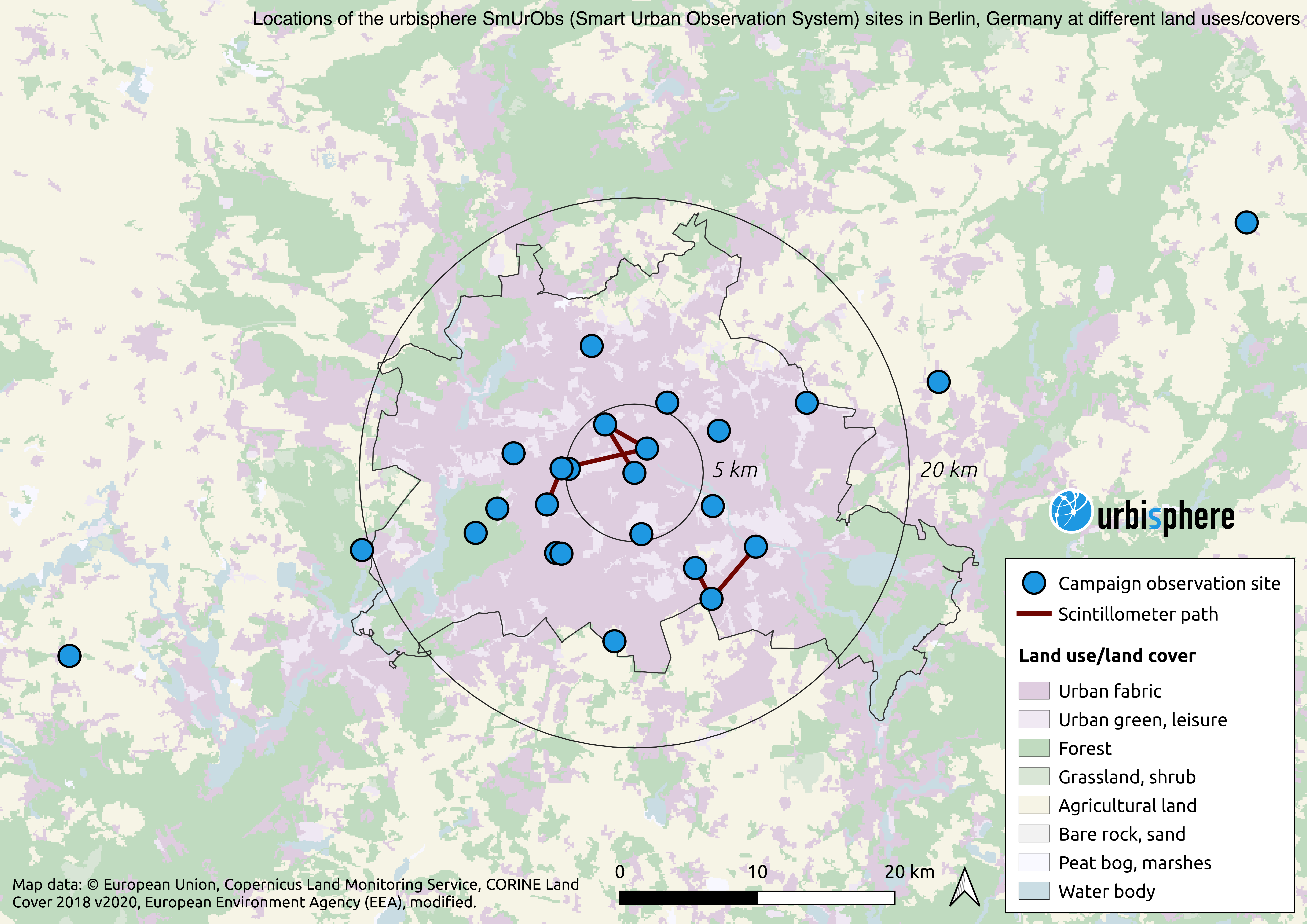
The following surface and ground-based remote-sensing instrumentation will be deployed and operated in the Berlin area within the built-up area and extending along a transect up to 100 km into Berlin’s rural surroundings:
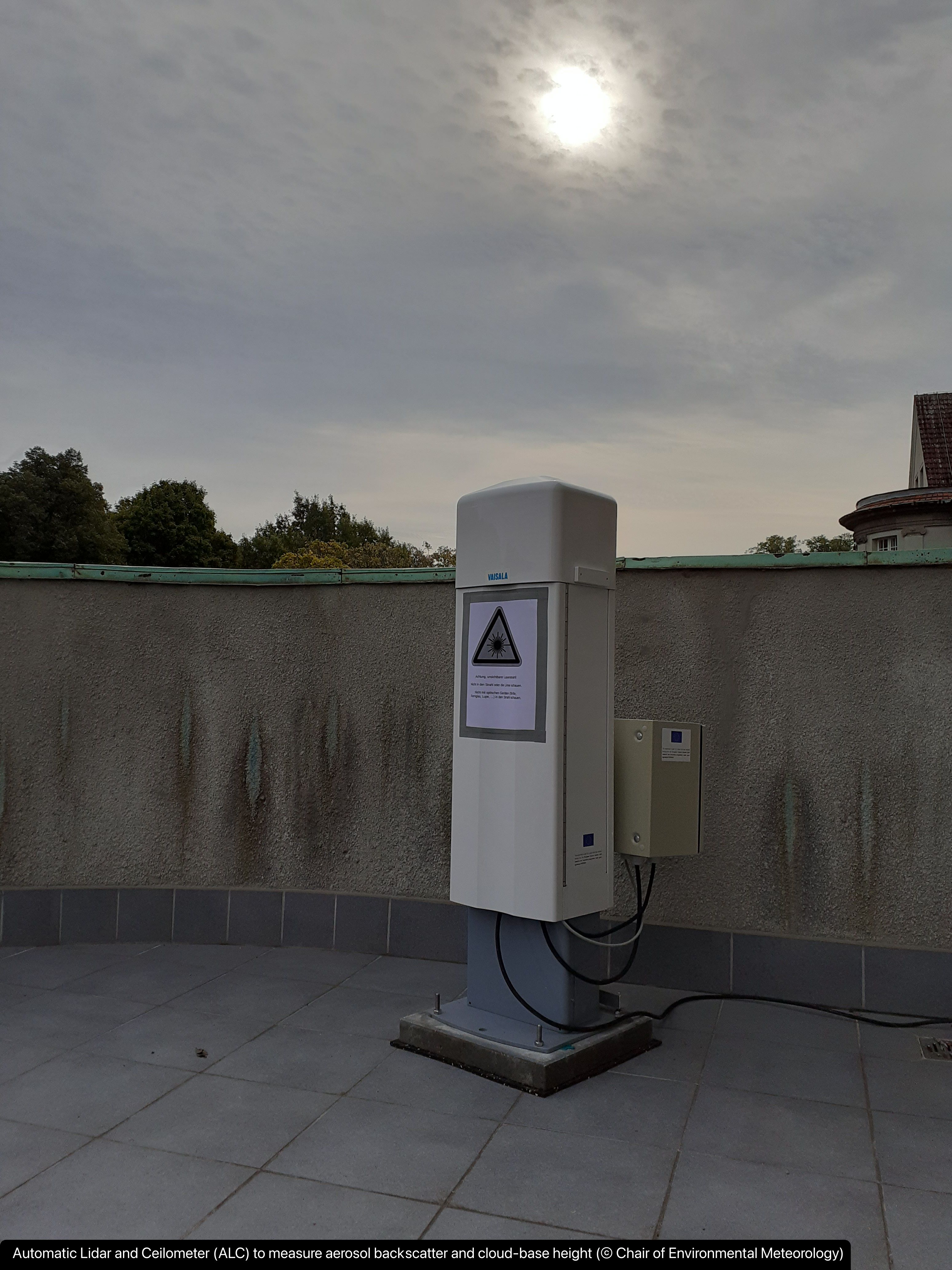
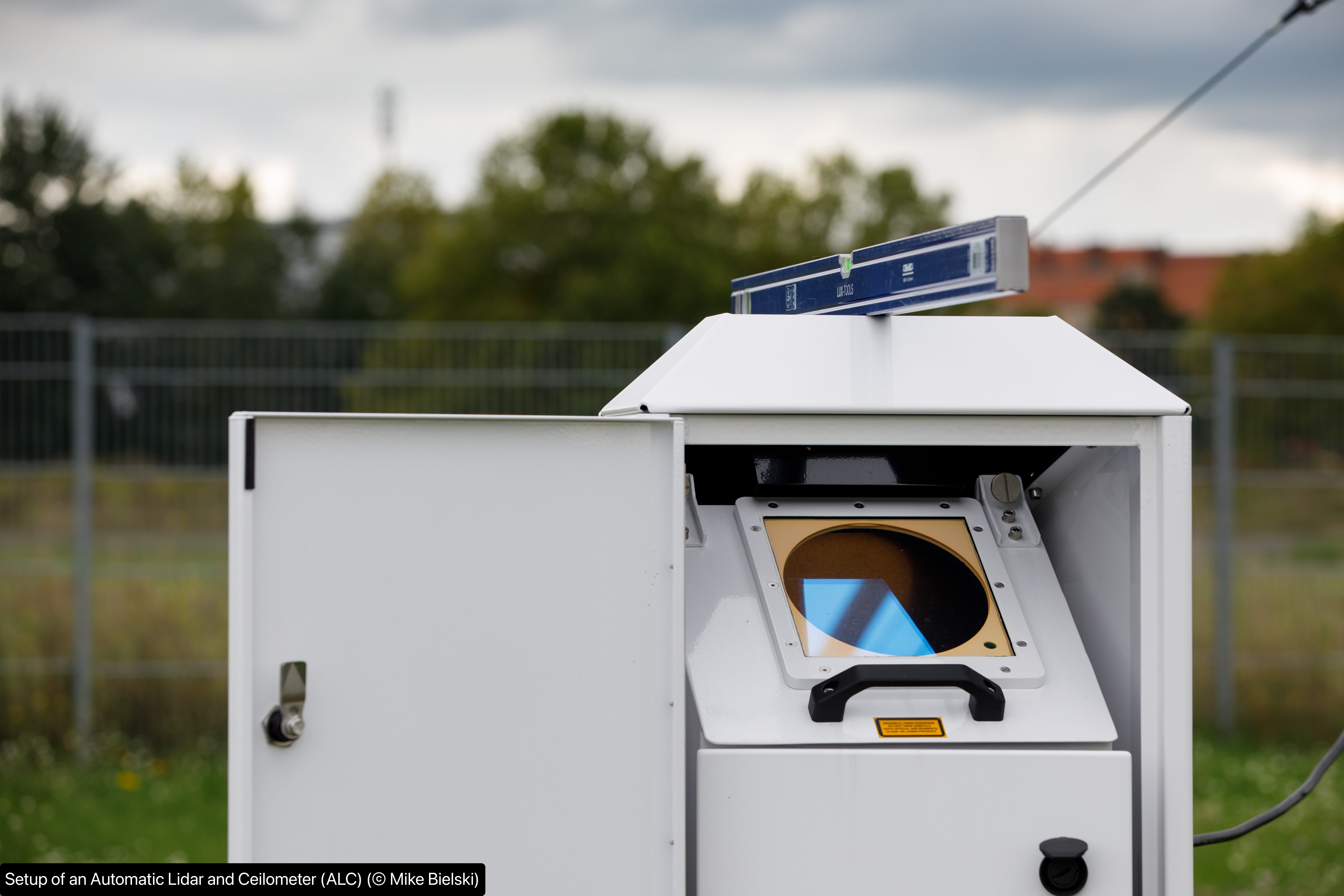
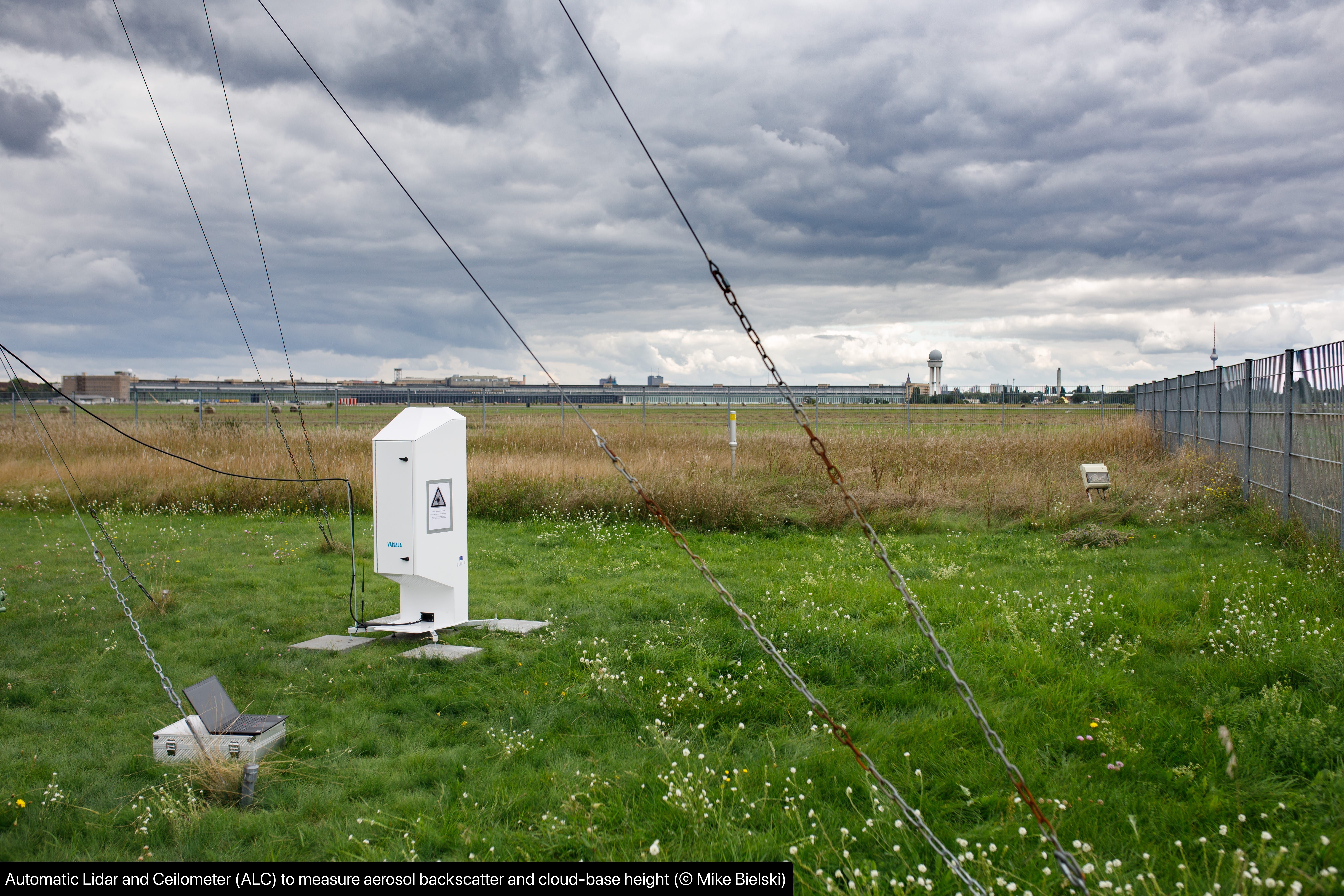
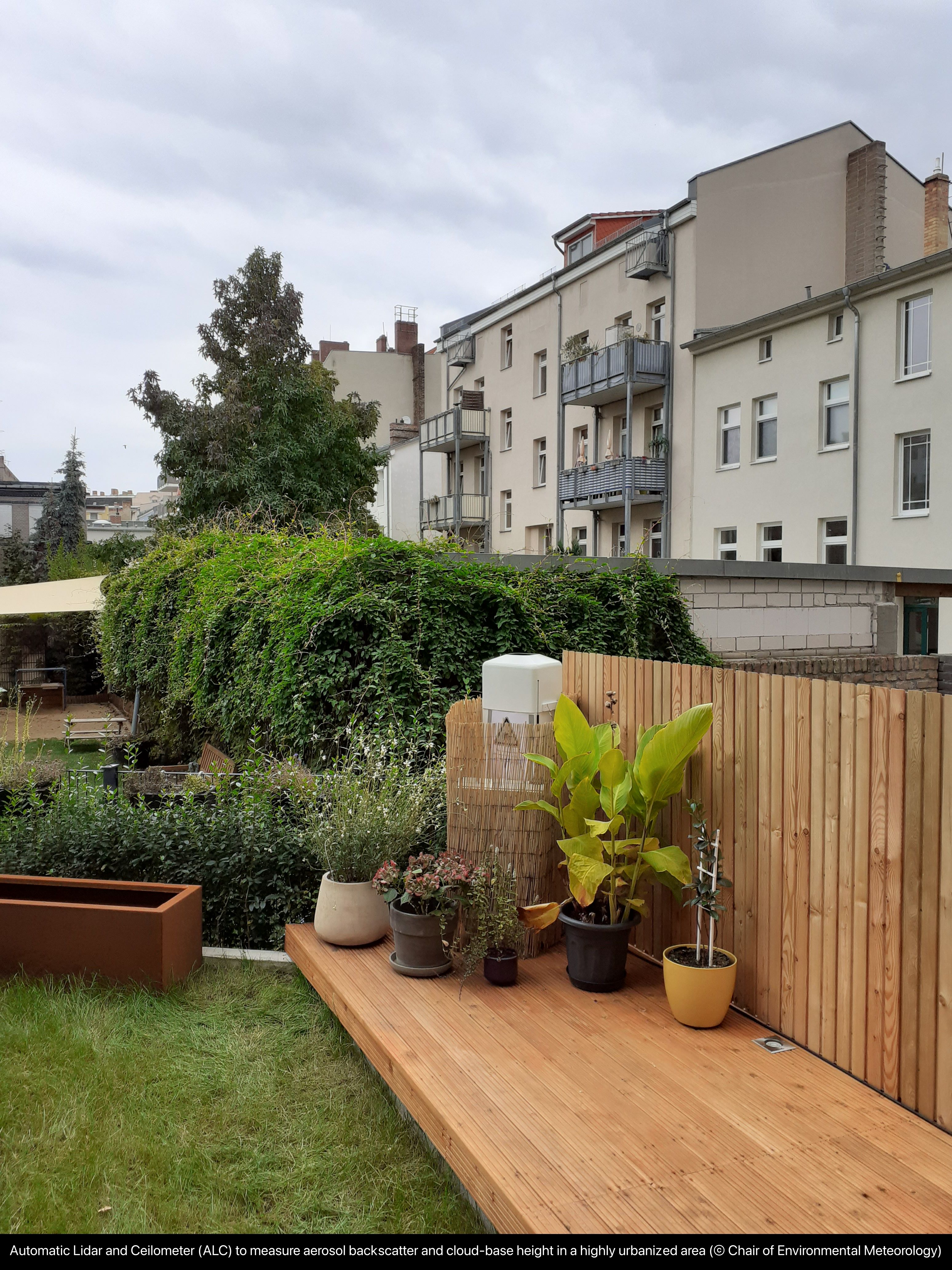
- A network of 12 additional automatic LIDAR and Ceilometer (ALC) systems complement existing operational systems and provide a very detailed and systematic picture of the three dimensional modification and the internal variability of aerosol, mixed-layer dynamics and clouds as air flows across an urbanized area along a transect.
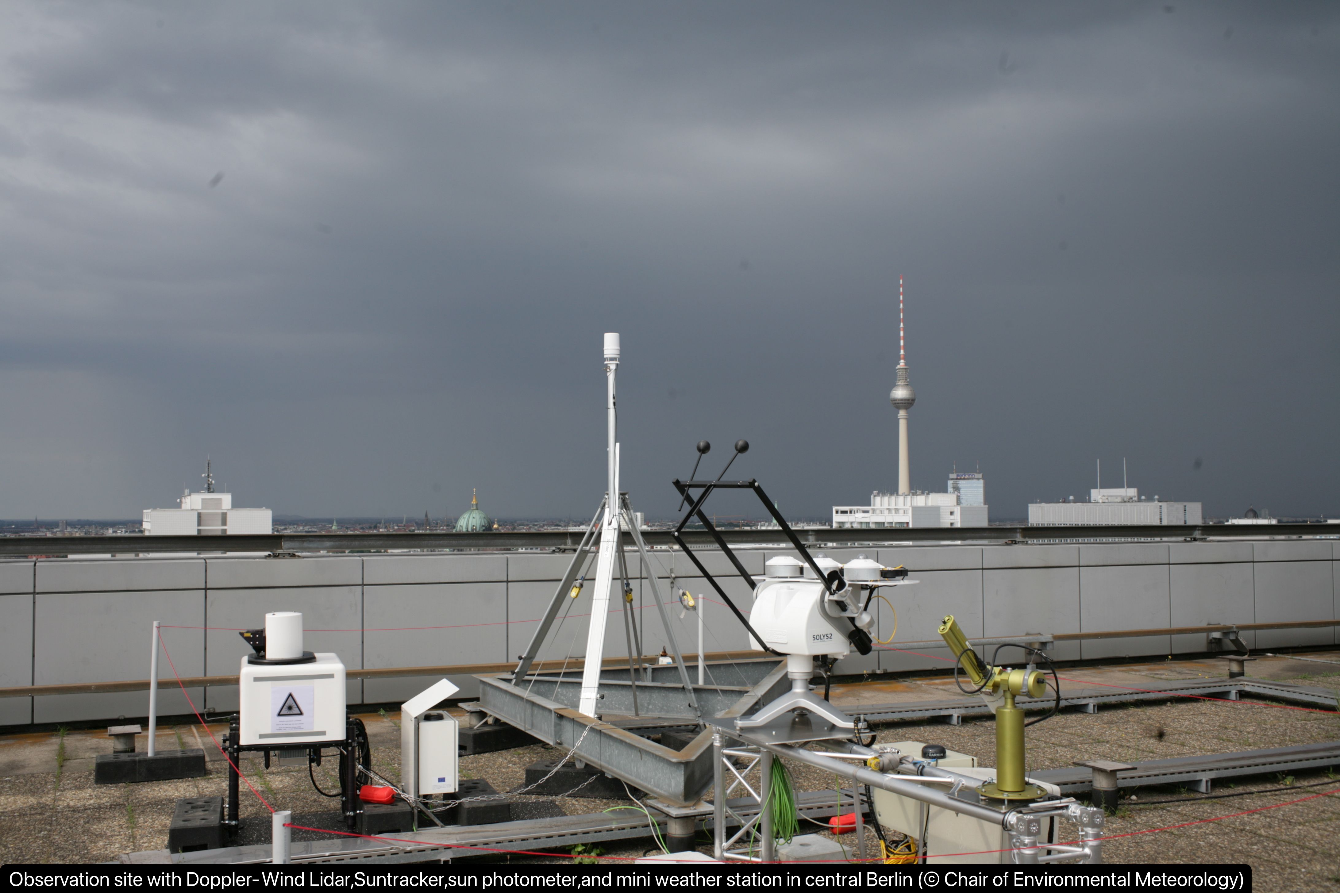
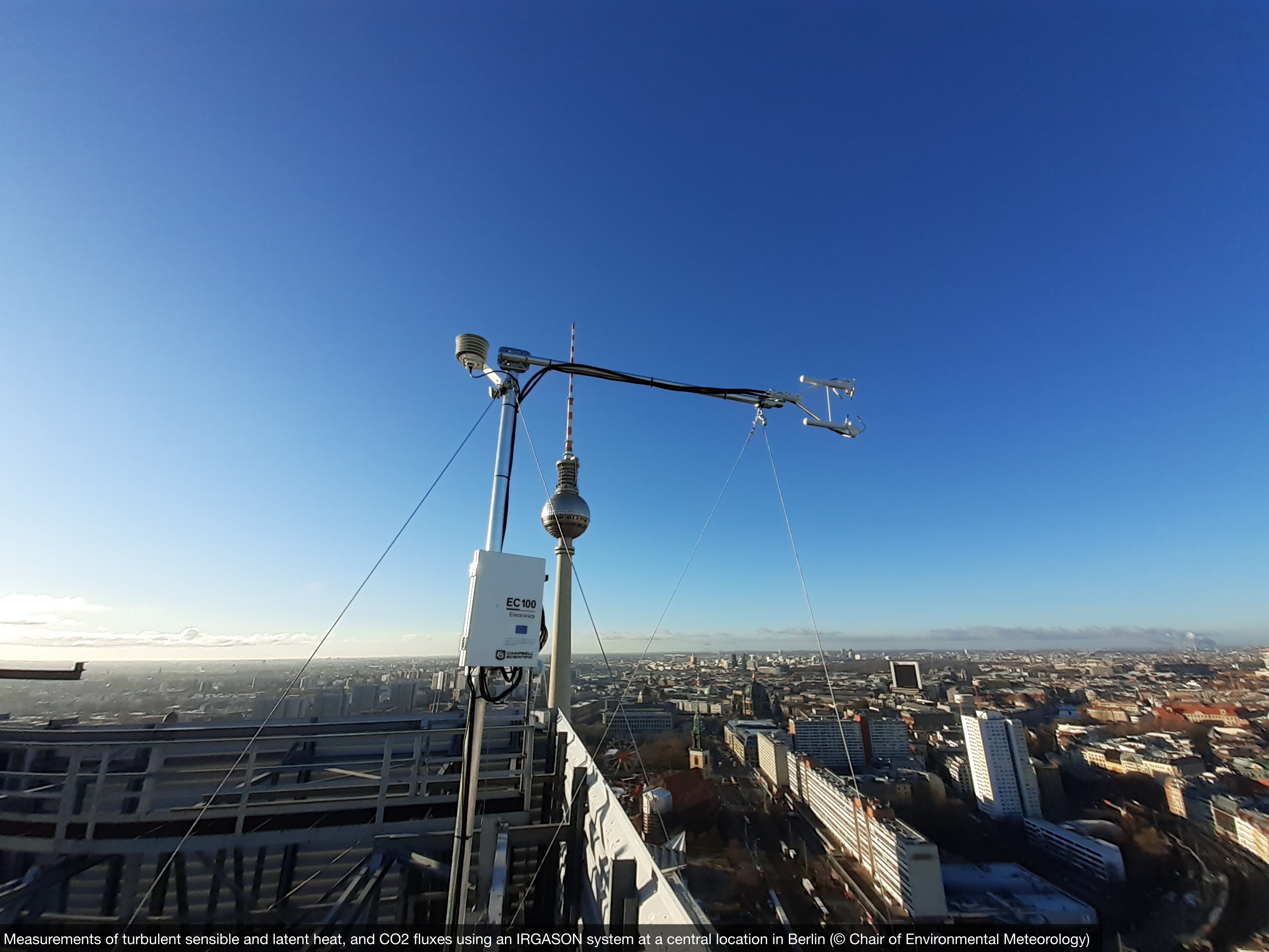
- Two additional Doppler Wind LIDARs will, in addition to existing Doppler Wind LIDARs operated by Technische Universität Berlin, allow for detailed information how flow and turbulence is modified by surface fluxes in the urban boundary layer along a W-E transect across the city.
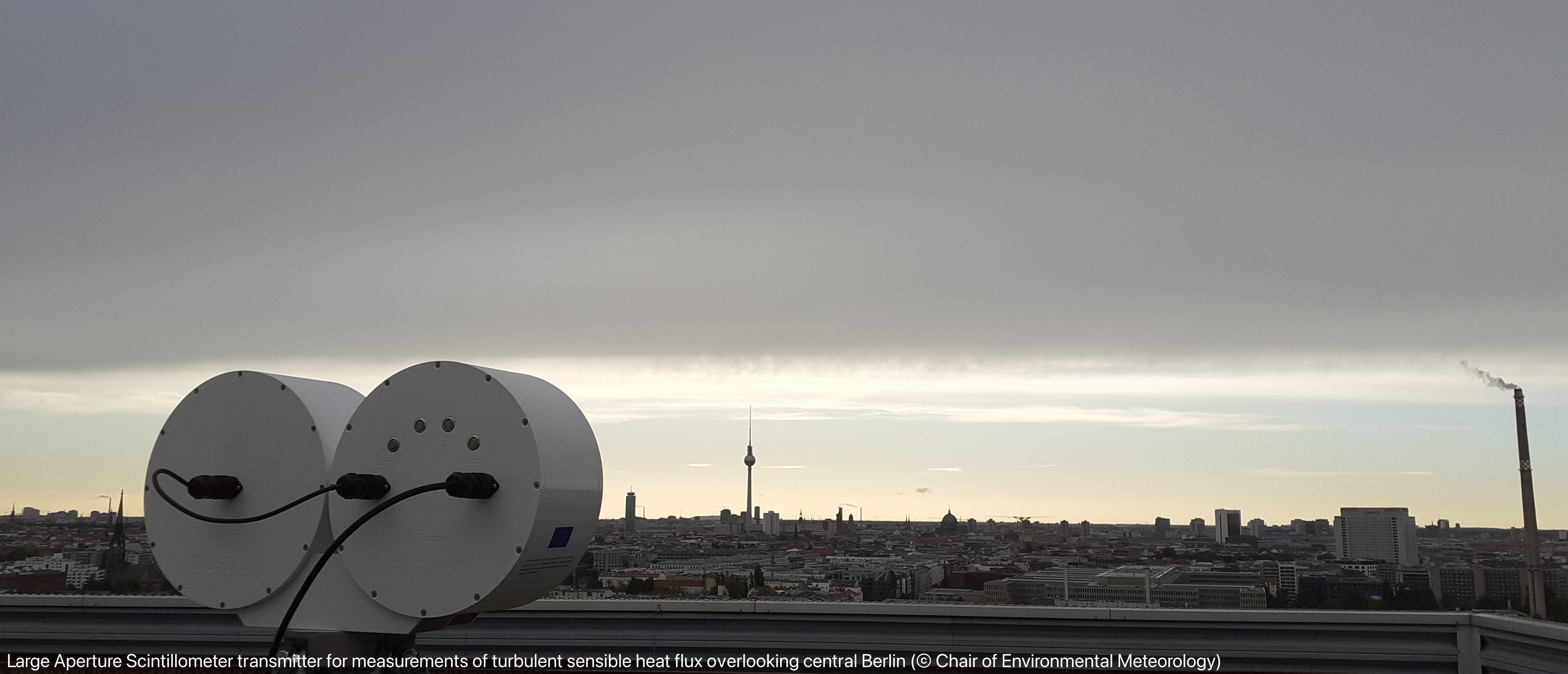
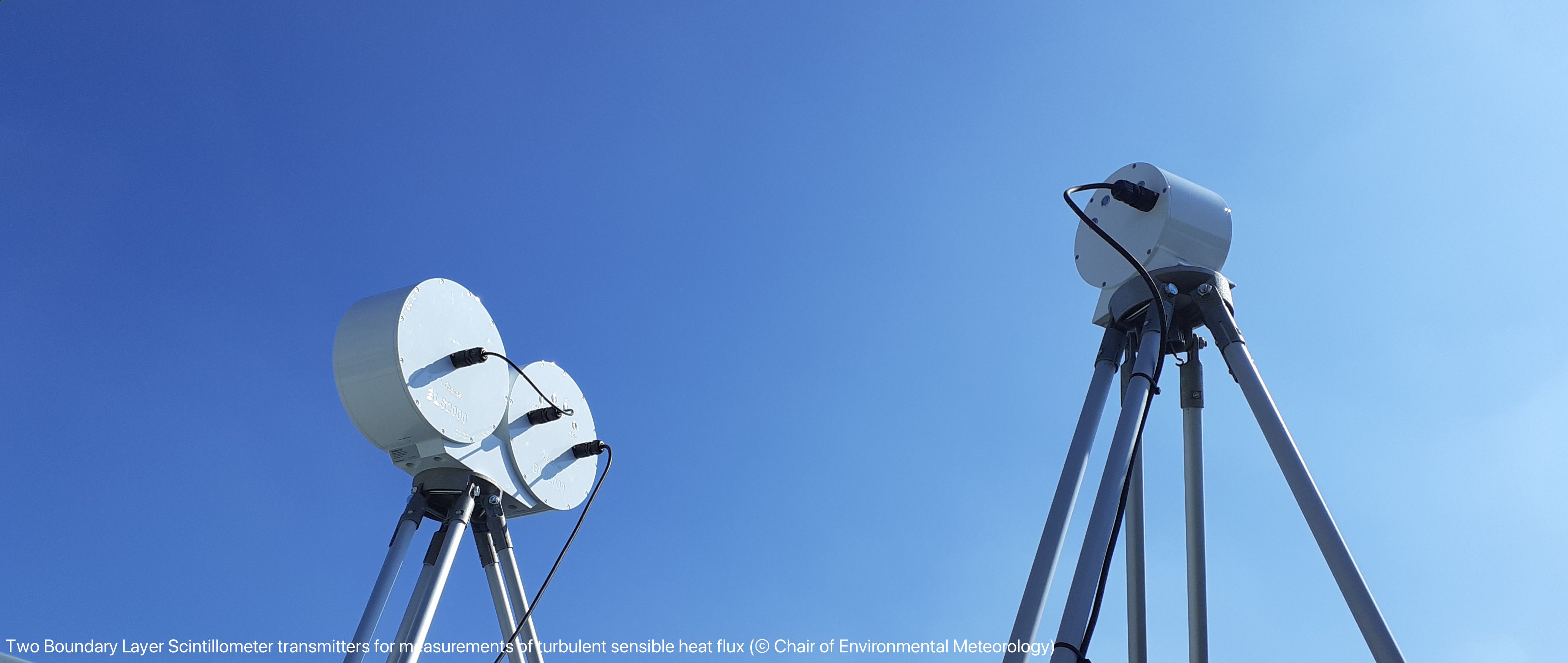
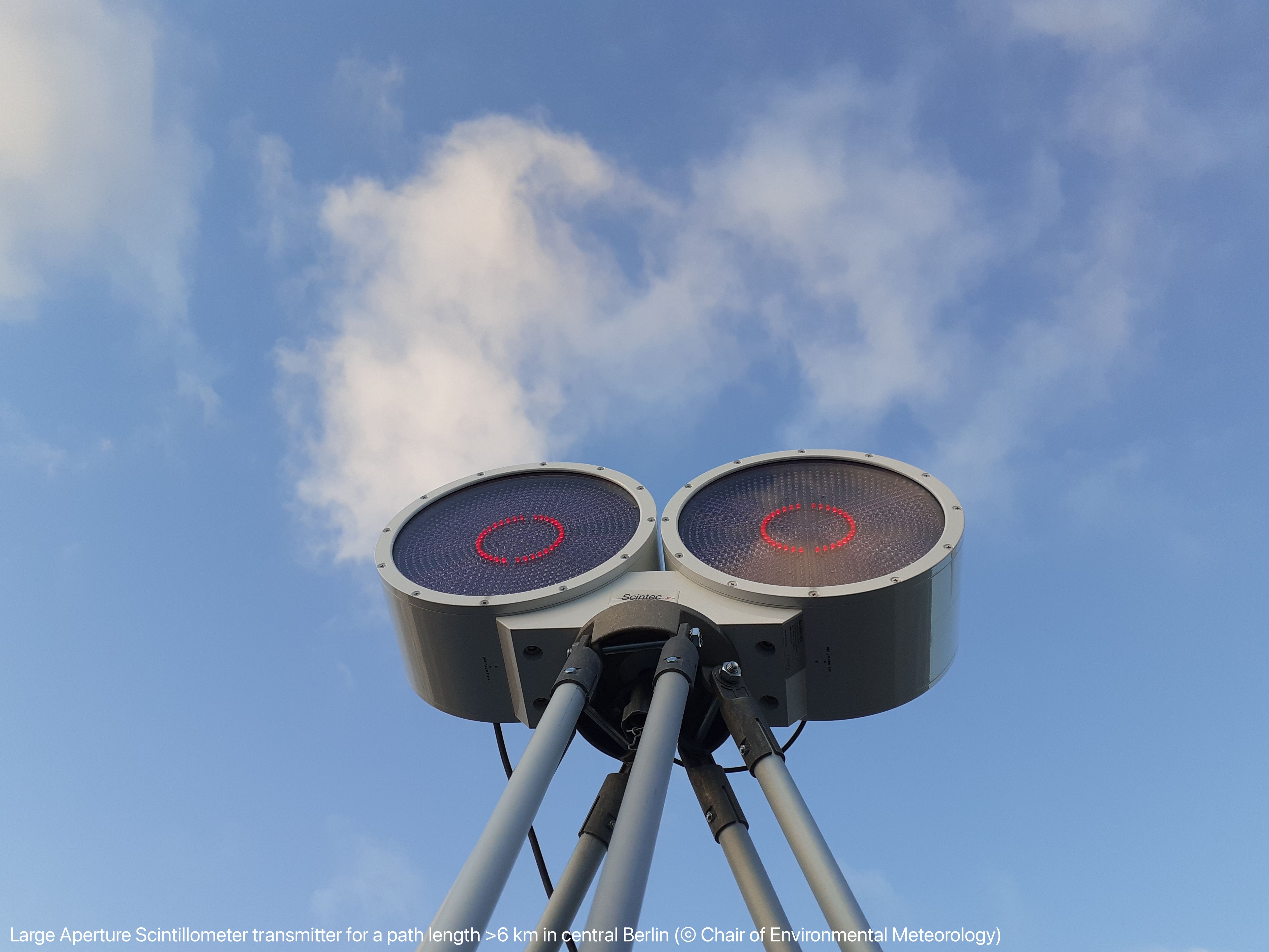
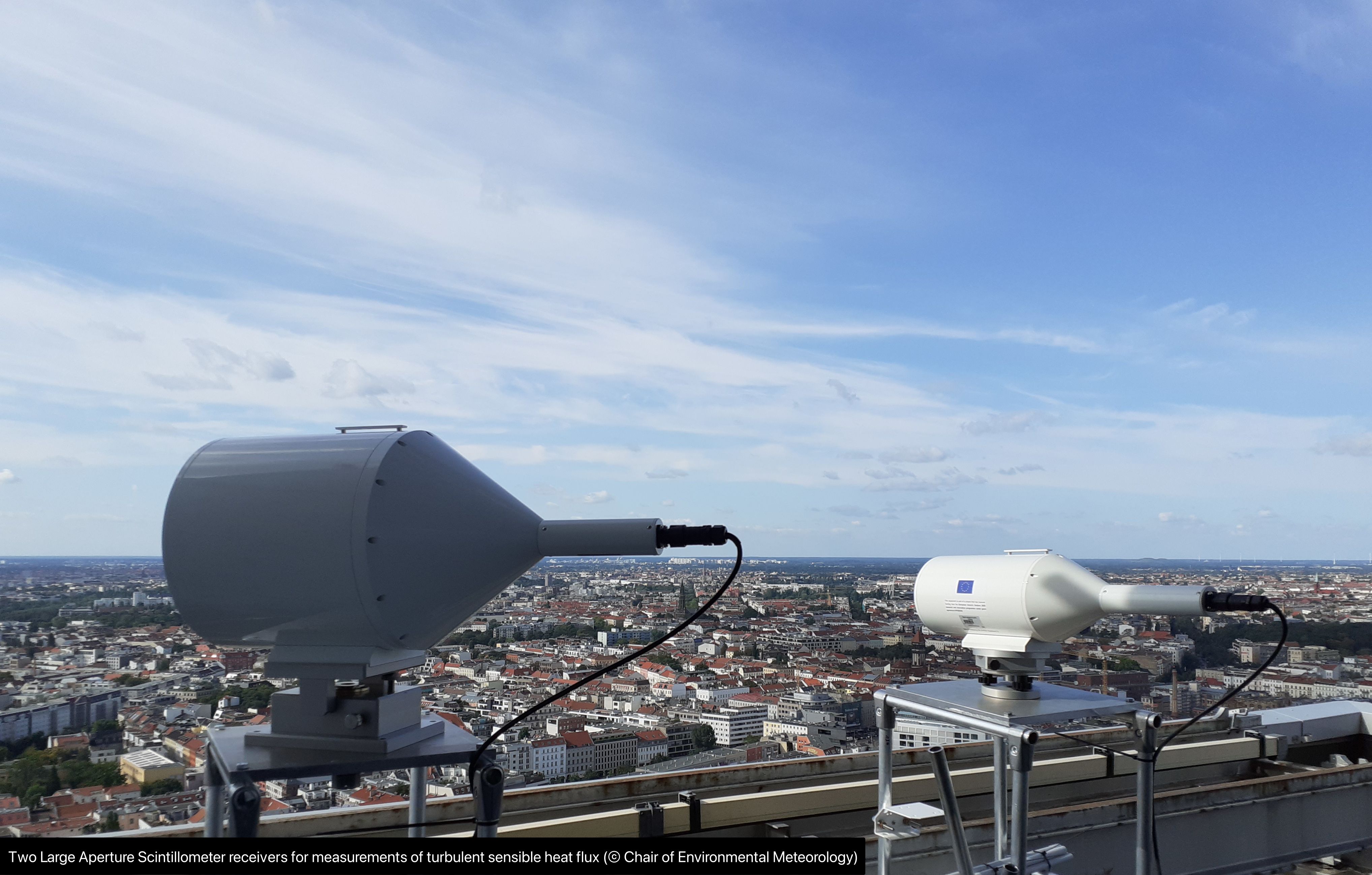
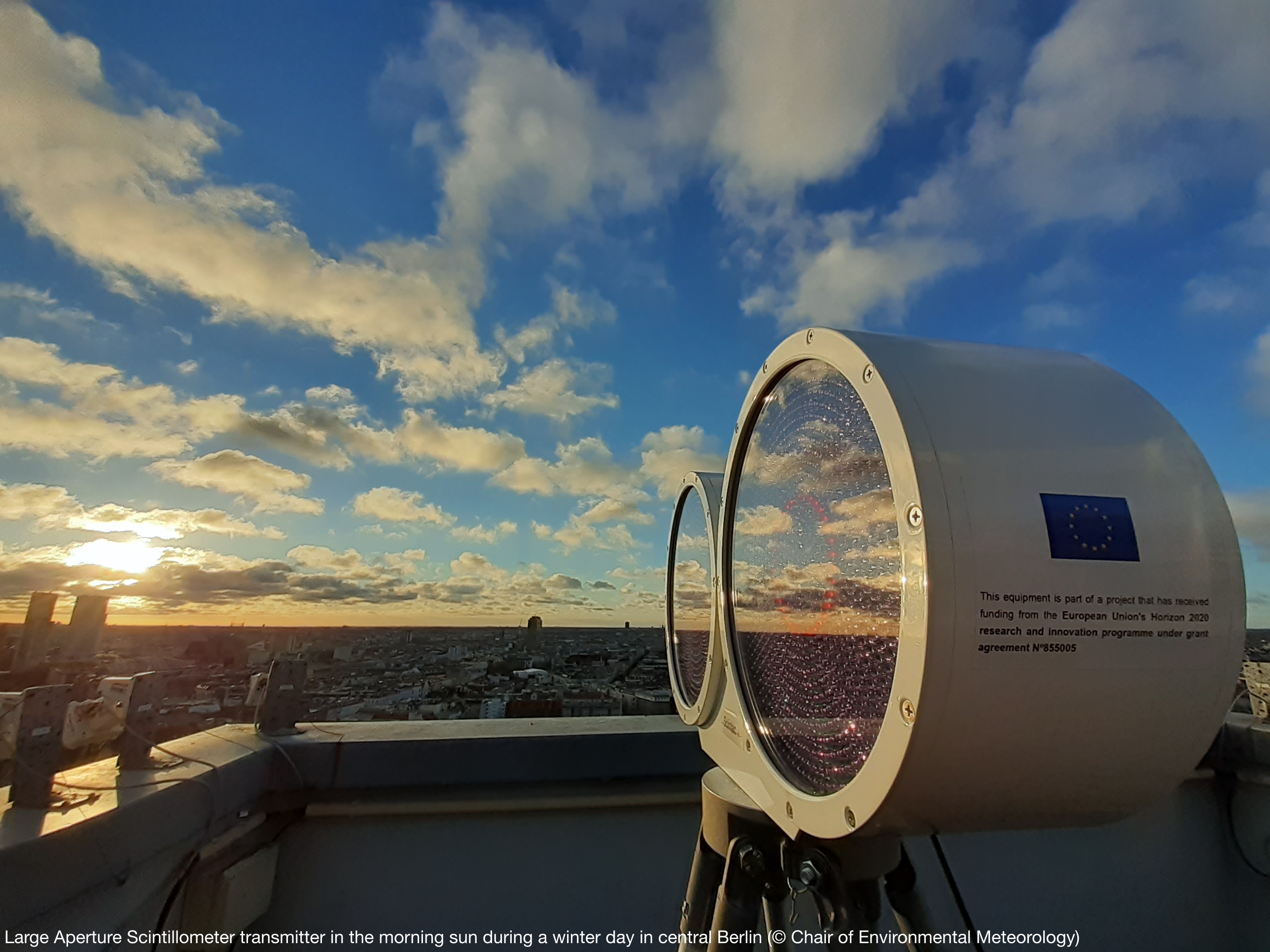
- Six large-aperture scintillometers measure sensible heat fluxes along paths of 3 to 6 km and represent surface fluxes from areas of contrasting density including the city center and outskirts. Using detailed scintillometer footprint modelling, we aim at simultaneously covering fluxes from all dominant urban classes, and identify intra-urban variability and retrieve metropolitan-average sensible heat fluxes.
- With a network of high-quality incoming radiation and visibility measurements, plus additional sun-photometer aerosol optical depth observations, we aim at quantifying the effect of the modified urban boundary layer, cloud and aerosol on surface radiative input and capture effects well beyond the built-up area.
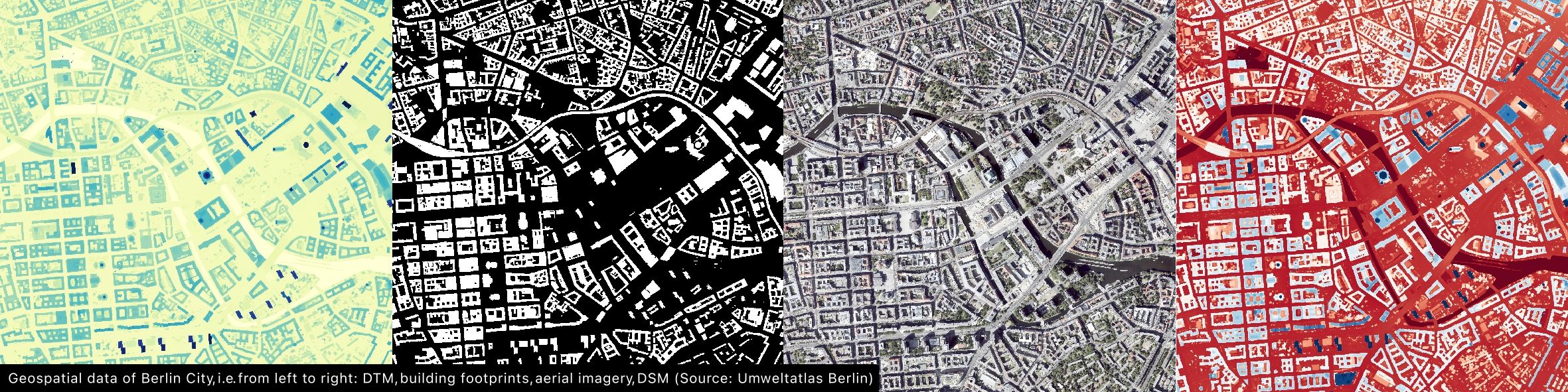
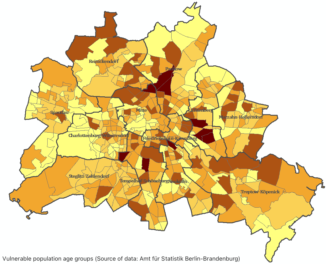
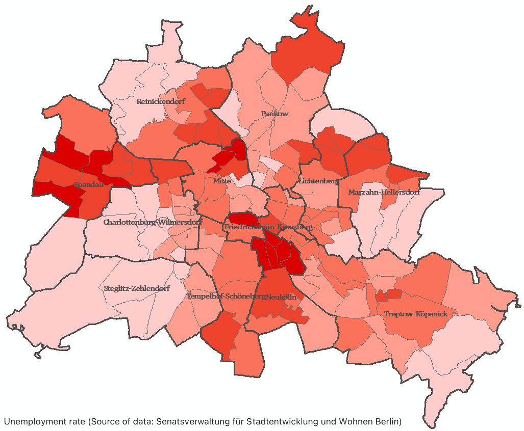
Towards compiling all required campaign information about Berlin, the meteorological observations are combined with satellite, additional aerial geospatial and socio-economic activity datasets. Regarding geospatial datasets, harmonized and homogenized products available for use have been created from existing datasets concerning Digital Terrain Model (DTM), Digital Surface Model (DSM), (3D) buildings, buildings’ use, aerial imageries, trees in public spaces, vegetation with heights, age of buildings (blocks), actual use of building blocks, traffic data, Lifeworld Oriented Spaces (LOR) and land use of Brandenburg (ALKIS). Regarding socio-economic datasets, harmonized products available for further use are being created from existing data, including age groups (vulnerable age groups), unemployment rate, level of education, household size, and population density, using the LOR spatial scale in Berlin.